In a subtle yet significant shift, Google Maps has updated its digital navigation platform to label a portion of the South China Sea as the “West Philippine Sea,” aligning with the Philippines’ designation for the western section of its exclusive economic zone (EEZ). This development, observed as of April 14, 2025, marks a milestone in Manila’s long-standing efforts to assert its sovereign rights in a region marred by geopolitical tensions, particularly with China. The update comes amid ongoing debates over territorial nomenclature and escalating confrontations in the disputed waters, reflecting a broader struggle for recognition and legitimacy on the global stage.
A Digital Victory for Philippine Sovereignty
The decision by Google Maps to adopt the “West Philippine Sea” label follows years of advocacy by Filipino officials, activists, and citizens. The term, officially designated by then-President Benigno Aquino III in 2012 through an administrative order, refers to the waters within the Philippines’ 200-nautical-mile EEZ in the South China Sea. This area overlaps with China’s expansive claims, often referred to as the “nine-dash line,” which were invalidated by a landmark 2016 arbitral ruling in favor of Manila at the Permanent Court of Arbitration in The Hague. Despite the ruling, Beijing has maintained its assertive posture, frequently deploying vessels to block Philippine fishermen and government ships from accessing traditional fishing grounds and resource-rich areas. 
Senator Francis Tolentino hailed the Google Maps update as a sign of “growing global recognition” for the West Philippine Sea, attributing it to the “collective efforts” of Filipinos. “This represents a victory for all Filipinos. It is also an affirmation of the correctness of the Philippines’ current policy to assert its sovereign rights in line with international law and multilateralism” Tolentino said in a statement on April 14, 2025. He further noted that the development stands in stark contrast to China’s “aggressive actions” in the region, which have included driving away Philippine vessels from areas within the country’s EEZ.
The update has also sparked reactions on social media, where Filipino economist Cielo Magno urged skeptics to “Google it” in a Facebook post on April 14. Her comment reflects a broader sentiment among Filipinos who see the digital recognition as a small but meaningful step toward reinforcing national identity and territorial claims in the face of international ambiguity.
Debates Over Nomenclature and Representation
The road to this digital acknowledgment has not been without controversy. Since February 2025, social media platforms have buzzed with discussions about how the West Philippine Sea is represented on Google Maps. Some users and pages claimed that the label was merely a user-generated “Google map pin,” a feature allowing individuals to mark locations, rather than an official designation by the platform. Herman Tiu Laurel, president of the Asian Century Philippines Strategic Studies Institute, pointed out that the West Philippine Sea appeared under a “business” category on Google, raising questions about the legitimacy and permanence of the label at the time.
Adding to the discourse, Sagip party-list Representative Rodante Marcoleta argued that while it is not incorrect to refer to the area as the West Philippine Sea domestically, the term lacks international recognition. “Well, internationally, it does not exist. Because if you see international maps, there is no West Philippine Sea” Marcoleta said during a One News interview on February 13, 2025. His comments underscore a persistent challenge for the Philippines: translating domestic assertions of sovereignty into globally accepted norms, especially in a region where powerful actors like China dominate the narrative.
Google’s decision to formalize the label, at least in part, may signal a shift in how neutral platforms navigate politically charged territorial disputes. While the tech giant has not issued an official statement on the update, its adoption of the term could influence public perception, particularly among international users who rely on Google Maps for geographic information. However, it remains unclear whether this change will extend to all regions or if it is tailored to users accessing the platform from the Philippines.
Looking Ahead: Talampas ng Pilipinas and Beyond
Beyond the West Philippine Sea, Senator Tolentino expressed optimism that Google Maps would soon incorporate another significant Filipino designation: “Talampas ng Pilipinas.” This term, translating to “Philippine Plateau,” was recently adopted under Section 8 of the Philippine Maritime Zones Act to rename the underwater region previously known as Benham Rise, located off the eastern coast of Luzon. The area, rich in marine biodiversity and potential mineral resources, was recognized by the United Nations in 2012 as part of the Philippines’ continental shelf. Despite this, it still appears as Benham Rise on Google Maps as of April 2025.
“This may change soon” Tolentino said, referencing the official submission of updated maps to the International Seabed Authority on March 27, 2025. He framed the renaming as a “legacy for the next generation and beyond,” emphasizing the cultural and strategic importance of asserting Filipino identity over maritime territories through language and cartography.
Geopolitical Context and Regional Tensions
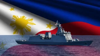
The Google Maps update arrives at a critical juncture in the South China Sea dispute, where overlapping claims involve not only the Philippines and China but also Vietnam, Malaysia, Brunei, and Taiwan. For Manila, the West Philippine Sea is not merely a geographic label but a symbol of national sovereignty and economic survival. The region encompasses vital fishing grounds and untapped energy reserves, resources that are increasingly contested as China ramps up its presence with artificial island construction and naval patrols.
Historical flashpoints, such as the 2012 standoff over Panatag Shoal (also known as Scarborough Shoal), highlight the stakes involved. Following that incident, China gained effective control over the shoal, a traditional fishing area for Filipinos, despite its proximity to the Philippine coast. The 2016 arbitral award, while a legal victory for Manila, has done little to alter the situation on the ground, as Beijing continues to reject the ruling and fortify its positions in the disputed waters.
The Philippines has responded with a mix of diplomatic engagement and military modernization, bolstered by alliances with the United States and other partners. Recent joint exercises with the US Navy in the West Philippine Sea, as well as increased cooperation with Japan and Australia, signal Manila’s intent to counterbalance China’s influence. However, these efforts are often met with aggressive responses, including water cannon attacks on Philippine vessels and blockades of resupply missions to Filipino troops stationed at the Second Thomas Shoal.
Implications of Digital Recognition
While a map label may seem trivial in the face of such complex geopolitical dynamics, it carries symbolic weight. Digital platforms like Google Maps shape public understanding of geography and politics, often serving as de facto arbiters of contested spaces in the absence of universal consensus. By adopting the West Philippine Sea designation, Google has, intentionally or not, lent credence to Manila’s perspective, potentially influencing how millions of users perceive the dispute.
Yet, this digital acknowledgment is unlikely to alter the physical realities of the South China Sea. China’s militarization of the region continues unabated, and smaller claimants like the Philippines must navigate a delicate balance between asserting their rights and avoiding escalation. If anything, the map update may provoke a reaction from Beijing, which has previously pressured international companies to align with its territorial claims, as seen in past disputes over airline references to Taiwan.
For now, the West Philippine Sea label on Google Maps stands as a quiet triumph for Filipino advocacy, a reminder of the power of persistence in shaping narratives. Whether it heralds broader international acceptance remains to be seen, as does its impact on the ground—or rather, at sea. As Senator Tolentino and others push for further recognition of Philippine maritime features, the interplay between digital cartography and real-world diplomacy will continue to unfold, offering a unique lens on one of the world’s most intractable conflicts.
As tensions persist in the South China Sea, questions linger about how far digital recognition can translate into tangible gains for the Philippines. For a nation striving to secure its place in a contested region, every small victory counts—but the horizon remains fraught with challenges.