
A tropical depression over the eastern part of the Hoàng Sa (Paracel) archipelago has escalated into the first typhoon of the year, named Wutip, posing a severe threat to central Vietnam and the Central Highlands. As of Wednesday morning, June 11, 2025, the storm’s eye was positioned over the eastern waters of the archipelago, with forecasts predicting torrential rains, high waves, and powerful winds through Friday. Vietnamese authorities are mobilizing emergency measures to mitigate the impact on vulnerable communities and infrastructure.
Storm’s Path and Intensity
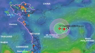
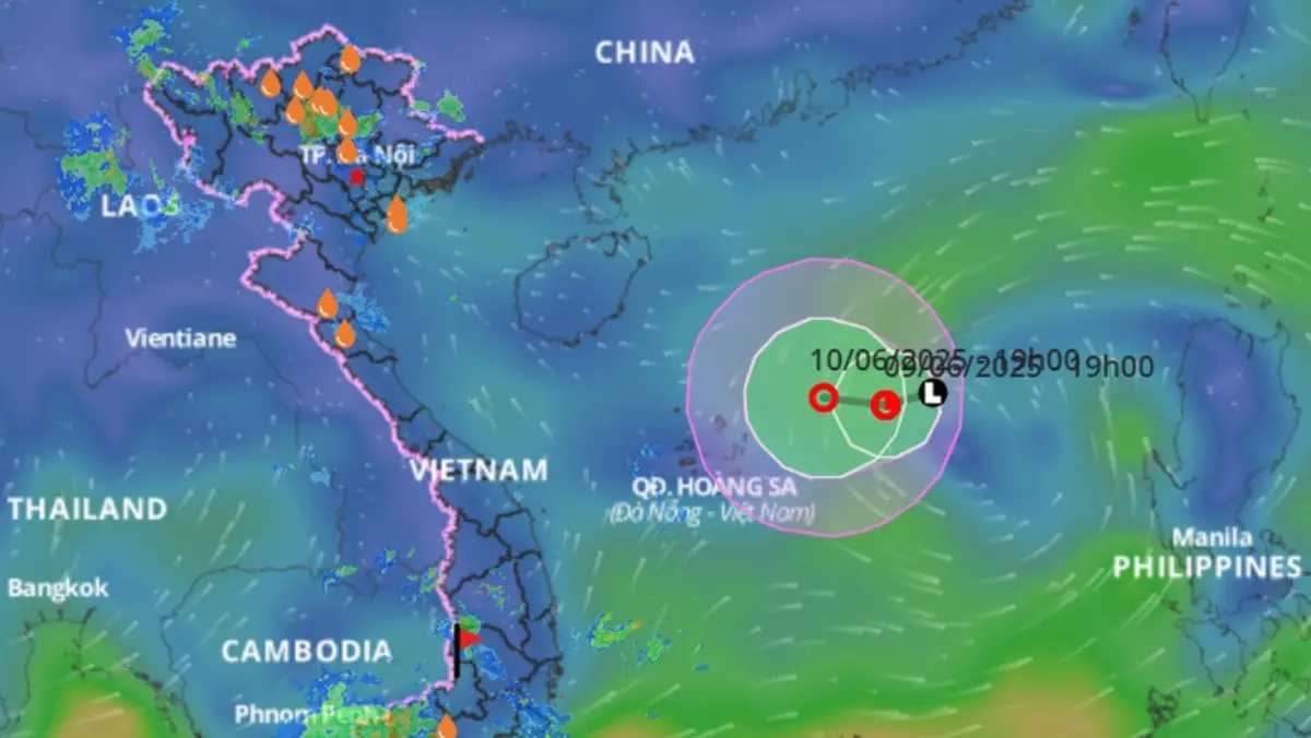
According to the National Centre for Hydrometeorological Forecasting, Typhoon Wutip’s eye was located at approximately 16.1 degrees North and 113.7 degrees East as of 7 a.m. on Wednesday. The storm’s strongest winds near the center have reached level 8 on the Beaufort scale, equivalent to 62–74 km/h, with gusts up to level 10. Moving slowly west-northwest at 5–10 km/h, the typhoon is expected to intensify as it approaches Vietnam’s central coast. 
The northern part of the East Sea, including areas around the Hoàng Sa (Paracel) archipelago, faces thunderstorms and winds escalating from levels 6–7 to 8–9, with gusts potentially reaching level 11. Waves in this region are projected to rise between 2.5 and 4.5 meters, creating hazardous sea conditions. Further south, near the Trường Sa (Spratly) archipelago, southwesterly winds are strengthening to level 6, occasionally hitting level 7, with waves of 2–4 meters.
Director Mai Văn Khiêm of the forecasting center emphasized the risks to maritime activities, stating “Vessels in these areas must brace for thunderstorms, squalls, and high waves” as reported by state media. Authorities have issued urgent warnings to all ships operating in the affected zones, urging caution and preparedness.
Heavy Rainfall and Flood Risks
From Wednesday evening through Friday, central Vietnam is expected to bear the brunt of Wutip’s impact, with rainfall accumulations forecasted at 100–300mm across the region. Some isolated areas could see totals exceeding 450mm, heightening the risk of flash floods and landslides, particularly in mountainous and low-lying areas. The northern Central Highlands is also bracing for moderate to heavy rain, with accumulations of 70–150mm and over 200mm in certain spots.
These projections echo the devastating effects of past storms like Typhoon Molave, which struck central Vietnam in October 2020, uprooting trees and displacing thousands in provinces like Quang Ngai. While rainfall is expected to taper off by Saturday, the immediate threat of flooding and infrastructure damage remains a critical concern for local authorities.
Government Response and Preparedness
In anticipation of the storm’s impact, Prime Minister Phạm Minh Chính issued an official dispatch on Tuesday, numbered 86/CĐ-TTg, directing ministries, agencies, and local authorities to prepare for the heavy rainfall initially forecasted from the tropical depression. The directive prioritizes the safety of vessels, including tourist boats, and calls for the evacuation of residents from high-risk areas prone to landslides and severe flooding.
The Prime Minister also underscored the need to secure critical infrastructure, industrial parks, and urban areas, particularly in low-lying zones vulnerable to inundation. Local leaders have been instructed to monitor the storm’s trajectory closely and tailor response measures to their specific conditions.
In parallel, the Ministry of Agriculture and Environment has urged coastal provinces from Quảng Ninh to Khánh Hòa to restrict vessel departures and ensure all boat owners and captains are informed of the storm’s position and potential dangers. Emergency response teams and resources are being mobilized for potential search and rescue operations, while national and local media outlets, including Vietnam News Agency and Việt Nam Television, are providing continuous updates on the storm’s development to keep the public informed.
Community and Economic Impacts
Central Vietnam, a region heavily reliant on agriculture and fishing, faces significant economic risks from Typhoon Wutip. Prolonged rainfall and flooding could damage rice paddies, aquaculture farms, and other livelihoods, compounding the challenges for rural communities still recovering from previous natural disasters. In urban centers, the strain on drainage systems and infrastructure could disrupt daily life and commerce, with potential costs running into millions of Vietnamese Dong (exact figures in USD to be determined based on upload date exchange rates).
Historically, storms in this region have exposed vulnerabilities in disaster preparedness, particularly in remote areas where communication and evacuation efforts are often delayed. The government’s proactive stance this time—issuing early warnings and mobilizing resources—signals an intent to mitigate such gaps, though the effectiveness of these measures will depend on local implementation and community cooperation.
Regional Context and Climate Trends
Typhoon Wutip’s emergence as the first major storm of 2025 aligns with broader climate patterns affecting Southeast Asia, where rising sea temperatures and changing weather systems have intensified the frequency and severity of tropical cyclones. Vietnam, with its long coastline and dense population centers in low-lying areas, remains particularly vulnerable. The East Sea, often referred to as the South China Sea in international contexts, serves as a breeding ground for such storms, impacting not only Vietnam but also neighboring countries like the Philippines and southern China.
Environmental experts have long warned that climate change exacerbates these risks, with higher rainfall totals and stronger winds becoming more common during typhoon seasons. While specific attribution to climate change for individual storms like Wutip requires further study, the trend underscores the urgency of bolstering resilience through improved infrastructure, early warning systems, and community education.
Public Sentiment and Challenges Ahead
As news of Typhoon Wutip spreads, public sentiment in central Vietnam reflects a mix of concern and cautious optimism. Many residents, hardened by past experiences with storms, are taking proactive steps—stockpiling supplies, reinforcing homes, and heeding evacuation orders. Yet, challenges remain, particularly for those in isolated areas where access to timely information and emergency services is limited.
The government’s call for round-the-clock monitoring and regular reporting to the Ministry of Agriculture and Environment indicates a structured response framework, but the true test will come in the storm’s aftermath. Will relief efforts reach the hardest-hit areas swiftly? Can infrastructure withstand the deluge? These questions loom large as Wutip approaches.
As central Vietnam braces for impact, the resilience of its people and the readiness of its leaders will be put to the test. The coming days will reveal whether lessons from past disasters have translated into effective action, offering a glimpse into the region’s capacity to weather not just this storm, but the growing challenges of a changing climate.